Collection: Illustrated State Maps
Explore illustrated state maps that celebrate the landscapes, landmarks, wildlife, and regional character of places across the United States. Designed as visual reference objects for curious homes and growing minds, these maps combine geography, culture, and storytelling in a format that encourages repeated discovery. Each piece is filled with hand-illustrated details that help children and adults build a stronger sense of place and regional identity over time. Thoughtfully designed for family spaces, classrooms, and reading nooks, these maps bring together learning, observation, and everyday beauty.
"This is exactly what I was looking for. I am having a going away party and I will allowing my guest to sign on the map and then framing it for my wall at my new place. This map is art and is perfect to capture my idea for my memories!"
— S. Johnson
-
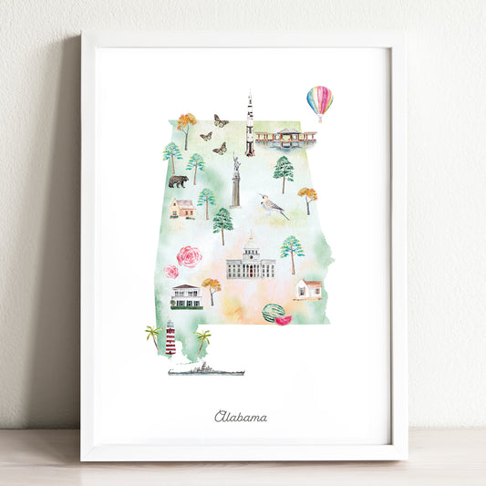
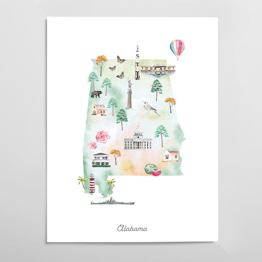
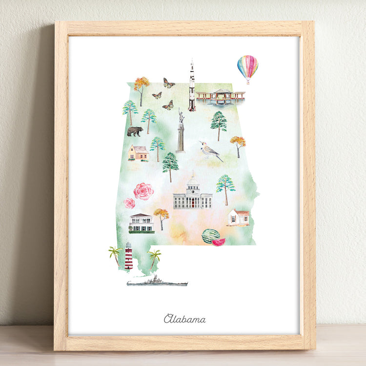
Alabama Illustrated State Map Art Print
Regular price From $ 24.00Regular priceUnit price per0.00 0.00Sale price From $ 24.00- Gradient
- Black
- Pink
- Blue
-
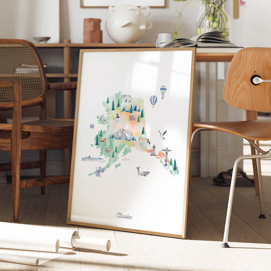
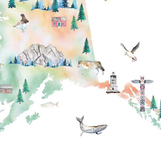
Alaska Illustrated State Map Art Print
Regular price From $ 24.00Regular priceUnit price per0.00 0.00Sale price From $ 24.00- Gradient
- Pink
- Blue
- Black
-
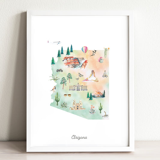
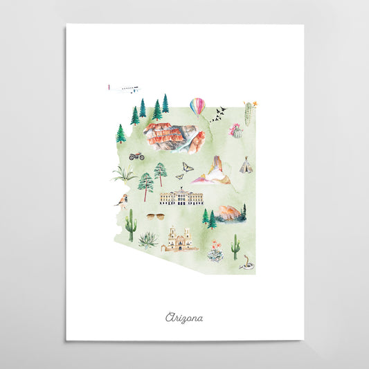
Arizona Illustrated State Map Art Print
Regular price From $ 24.00Regular priceUnit price per0.00 0.00Sale price From $ 24.00- Gradient
- Pink
- Blue
- Black
-
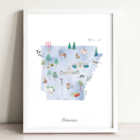
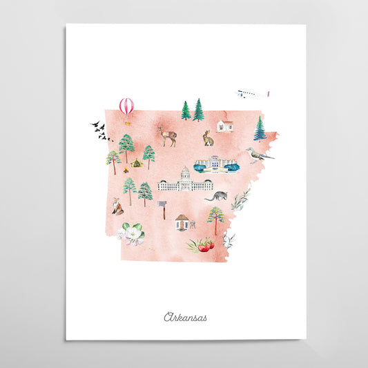
Arkansas Illustrated State Map Art Print
Regular price From $ 24.00Regular priceUnit price per0.00 0.00Sale price From $ 24.00- Gradient
- Black
- Pink
- Blue
-
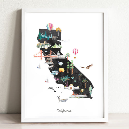
California Illustrated State Map Art Print
Regular price From $ 24.00Regular priceUnit price per0.00 0.00Sale price From $ 24.00- Gradient
- Black
- Pink
- Blue
-
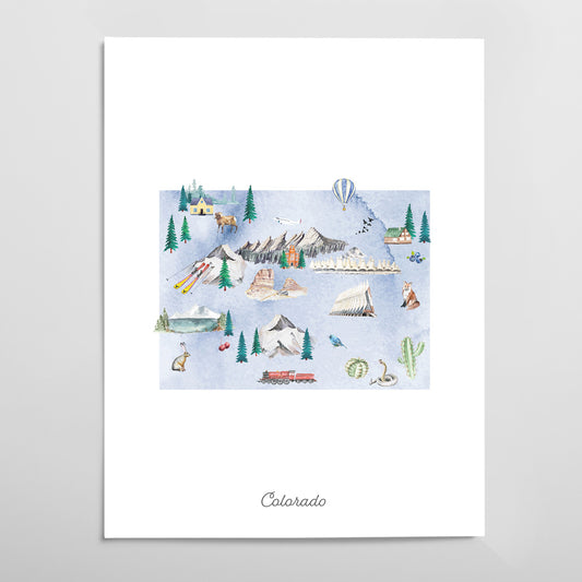
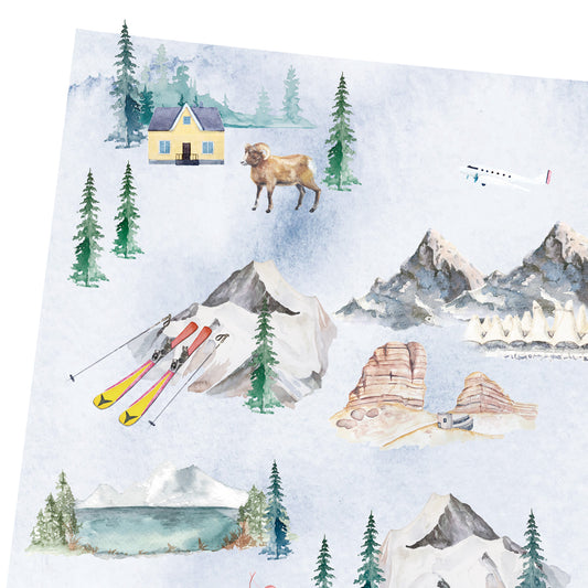
Colorado Illustrated State Map Art Print
Regular price From $ 24.00Regular priceUnit price per0.00 0.00Sale price From $ 24.00- Gradient
- Black
- Pink
- Blue
-
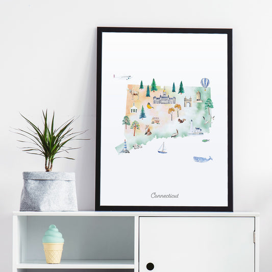
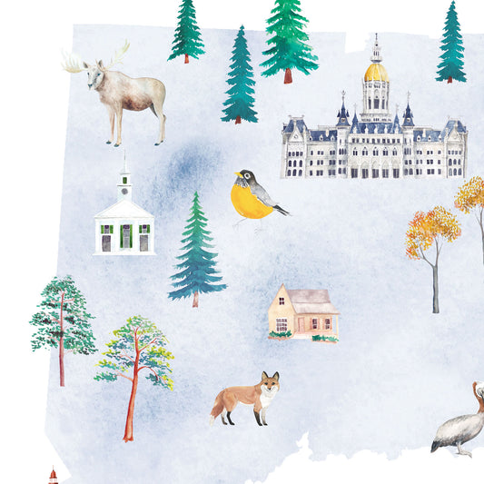
Connecticut Illustrated State Map Art Print
Regular price From $ 24.00Regular priceUnit price per0.00 0.00Sale price From $ 24.00- Gradient
- Black
- Pink
- Blue
-
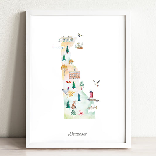
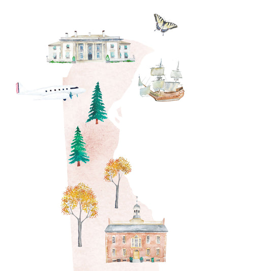
Delaware Illustrated State Map Art Print
Regular price From $ 24.00Regular priceUnit price per0.00 0.00Sale price From $ 24.00- Gradient
- Black
- Pink
- Blue
-
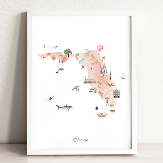
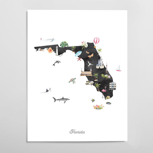
Florida Illustrated State Map Art Print
Regular price From $ 24.00Regular priceUnit price per0.00 0.00Sale price From $ 24.00- Gradient
- Black
- Pink
- Blue
-
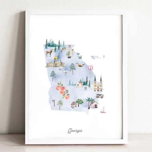
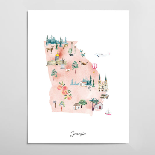
Georgia Illustrated State Map Art Print
Regular price From $ 24.00Regular priceUnit price per0.00 0.00Sale price From $ 24.00- Gradient
- Black
- Pink
- Blue
-
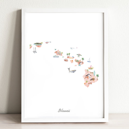
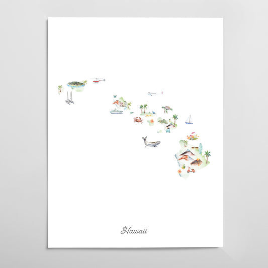
Hawaii Illustrated State Map Art Print
Regular price From $ 24.00Regular priceUnit price per0.00 0.00Sale price From $ 24.00- Gradient
- Black
- Pink
- Blue
-
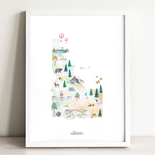
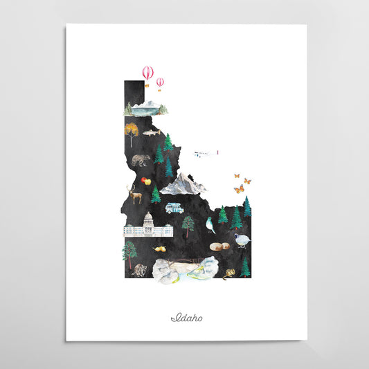
Idaho Illustrated State Map Art Print
Regular price From $ 24.00Regular priceUnit price per0.00 0.00Sale price From $ 24.00- Gradient
- Black
- Pink
- Blue
-
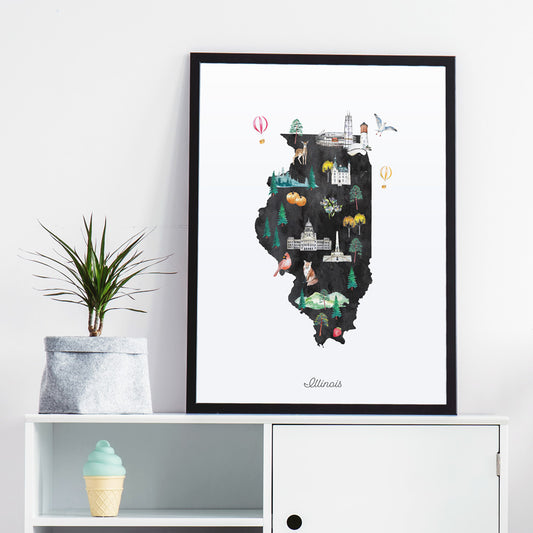
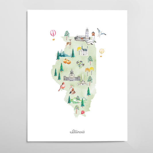
Illinois Illustrated State Map Art Print
Regular price From $ 24.00Regular priceUnit price per0.00 0.00Sale price From $ 24.00- Gradient
- Black
- Pink
- Blue
-
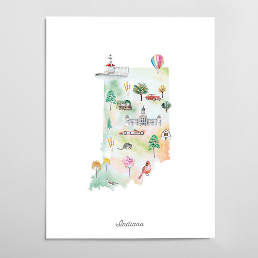
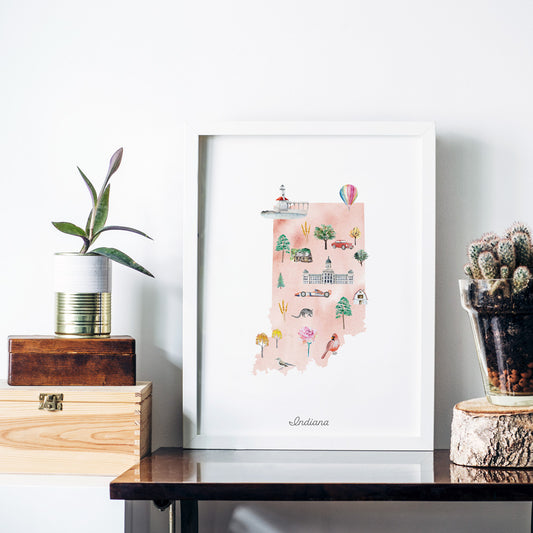
Indiana Illustrated State Map Art Print
Regular price From $ 24.00Regular priceUnit price per0.00 0.00Sale price From $ 24.00- Gradient
- Black
- Pink
- Blue
-
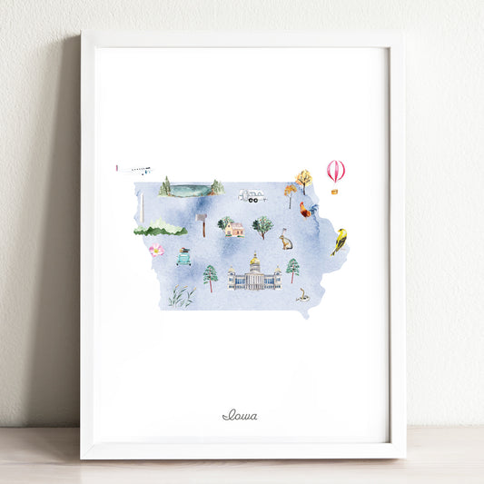
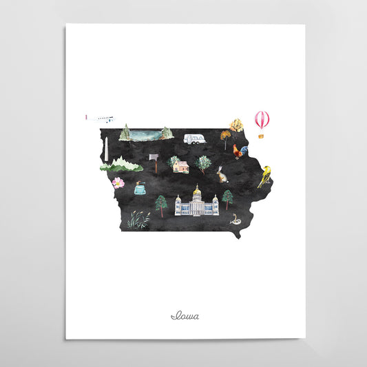
Iowa Illustrated State Map Art Print
Regular price From $ 24.00Regular priceUnit price per0.00 0.00Sale price From $ 24.00- Gradient
- Black
- Pink
- Blue
-
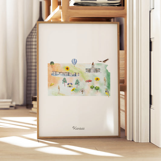
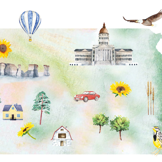
Kansas Illustrated State Map Art Print
Regular price From $ 24.00Regular priceUnit price per0.00 0.00Sale price From $ 24.00- Gradient
- Black
- Pink
- Blue
-
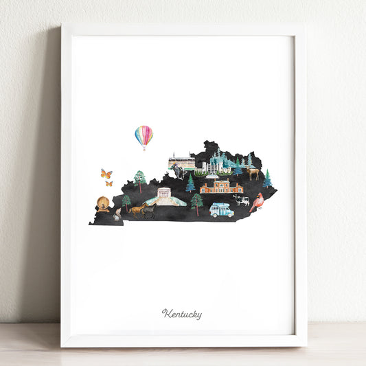
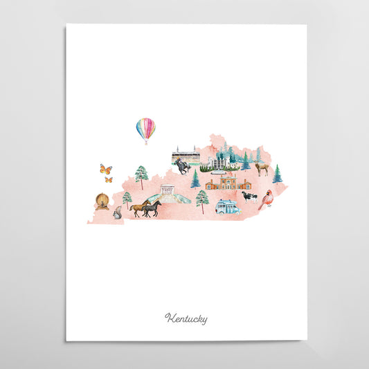
Kentucky Illustrated State Map Art Print
Regular price From $ 24.00Regular priceUnit price per0.00 0.00Sale price From $ 24.00- Gradient
- Black
- Pink
- Blue
-
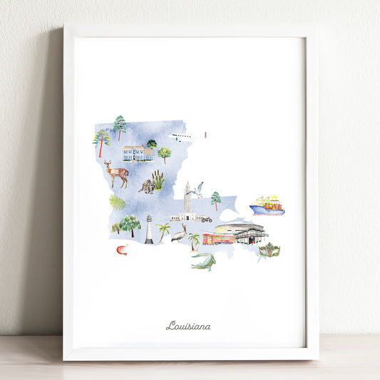
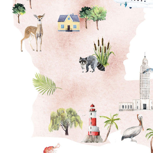
Louisiana Illustrated State Map Art Print
Regular price From $ 24.00Regular priceUnit price per0.00 0.00Sale price From $ 24.00- Gradient
- Black
- Pink
- Blue
-
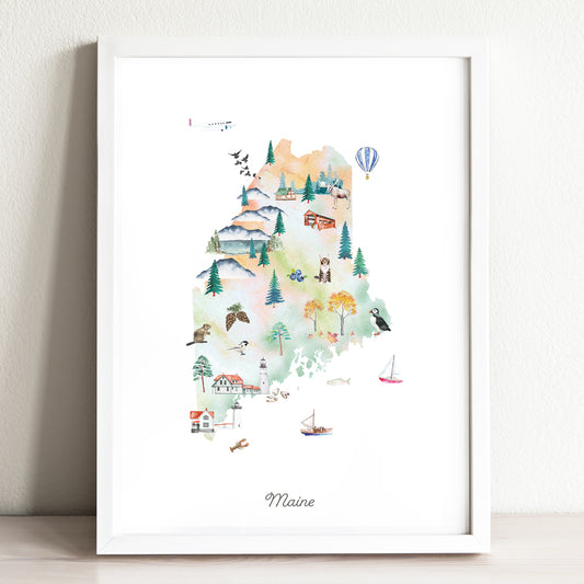
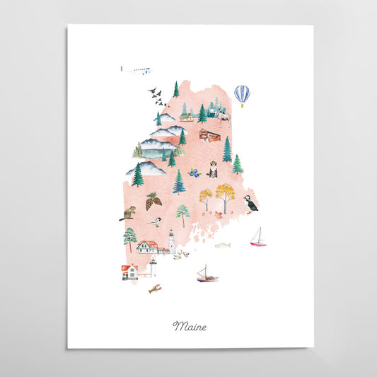
Maine Illustrated State Map Art Print
Regular price From $ 24.00Regular priceUnit price per0.00 0.00Sale price From $ 24.00- Gradient
- Black
- Pink
- Blue
-
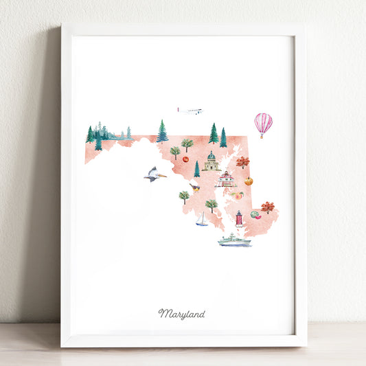
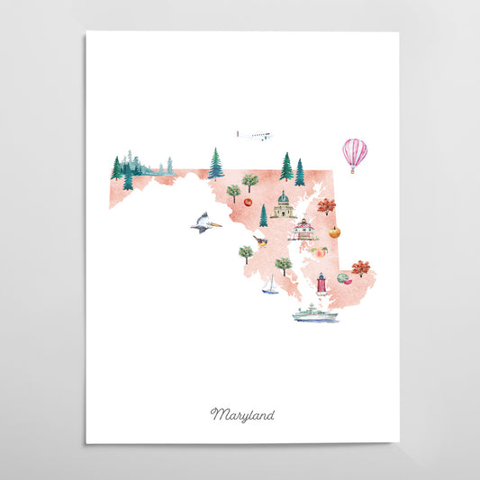
Maryland Illustrated State Map Art Print
Regular price From $ 24.00Regular priceUnit price per0.00 0.00Sale price From $ 24.00- Gradient
- Black
- Pink
- Blue
-
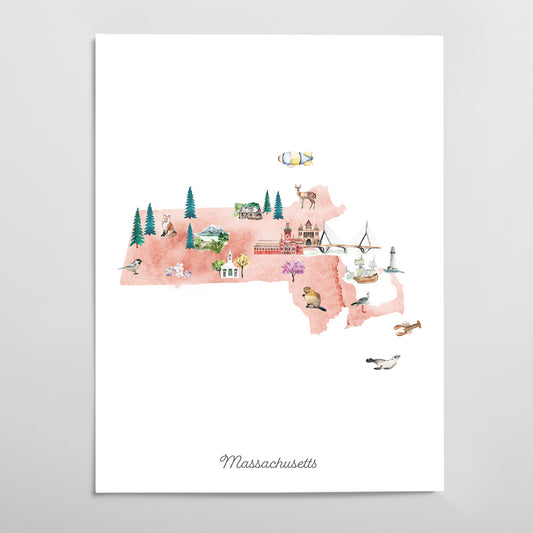
Massachusetts Illustrated State Map Art Print
Regular price From $ 24.00Regular priceUnit price per0.00 0.00Sale price From $ 24.00- Gradient
- Black
- Pink
- Blue
-
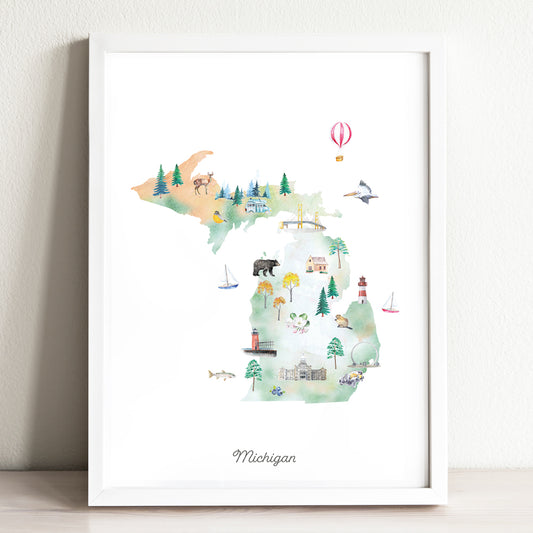
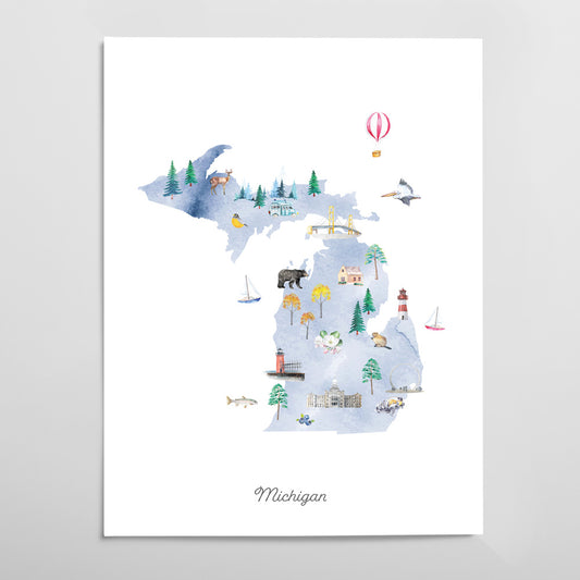
Michigan Illustrated State Map Art Print
Regular price From $ 24.00Regular priceUnit price per0.00 0.00Sale price From $ 24.00- Gradient
- Black
- Pink
- Blue
-
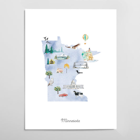
Minnesota Illustrated State Map Art Print
Regular price From $ 24.00Regular priceUnit price per0.00 0.00Sale price From $ 24.00- Gradient
- Black
- Pink
- Blue
-
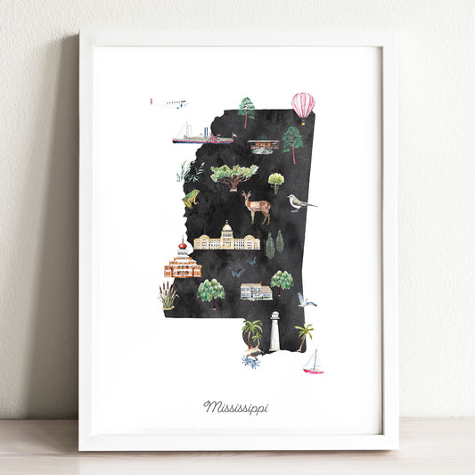
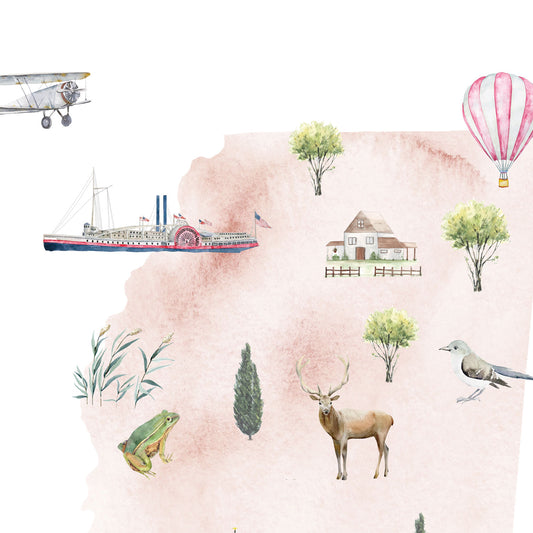
Mississippi Illustrated State Map Art Print
Regular price From $ 24.00Regular priceUnit price per0.00 0.00Sale price From $ 24.00- Gradient
- Black
- Pink
- Blue
-
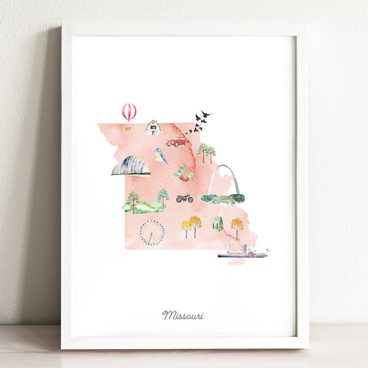
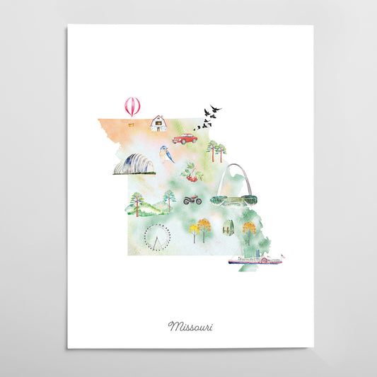
Missouri Illustrated State Map Art Print
Regular price From $ 24.00Regular priceUnit price per0.00 0.00Sale price From $ 24.00- Gradient
- Black
- Pink
- Blue
-
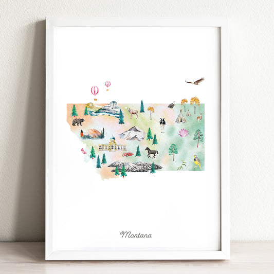
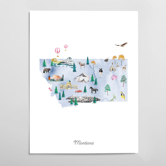
Montana Illustrated State Map Art Print
Regular price From $ 24.00Regular priceUnit price per0.00 0.00Sale price From $ 24.00- Gradient
- Black
- Pink
- Blue
-
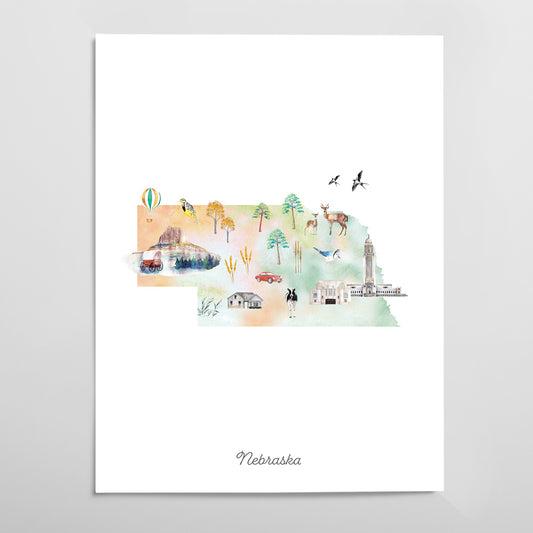
Nebraska Illustrated State Map Art Print
Regular price From $ 24.00Regular priceUnit price per0.00 0.00Sale price From $ 24.00- Gradient
- Black
- Pink
- Blue
-
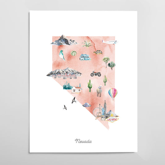
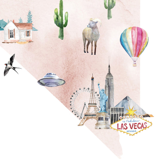
Nevada Illustrated State Map Art Print
Regular price From $ 24.00Regular priceUnit price per0.00 0.00Sale price From $ 24.00- Gradient
- Black
- Pink
- Blue
-
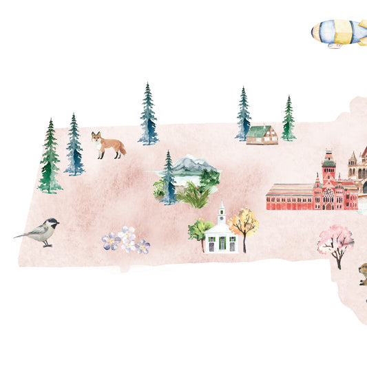
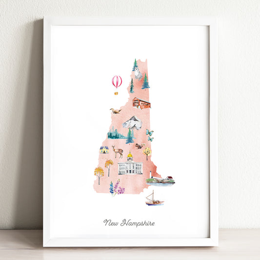
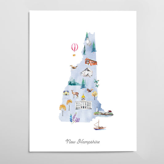
New Hampshire Illustrated State Map Art Print
Regular price From $ 24.00Regular priceUnit price per0.00 0.00Sale price From $ 24.00- Gradient
- Black
- Pink
- Blue
-
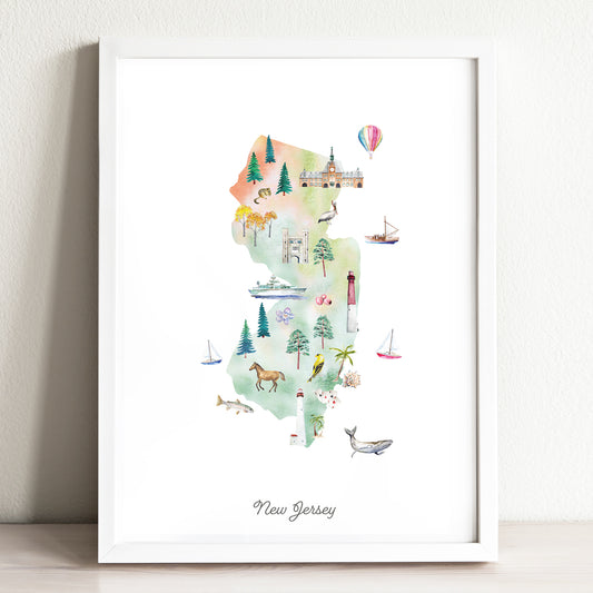
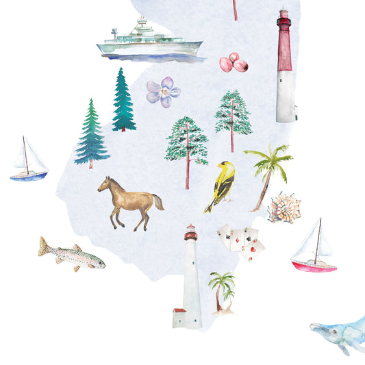
New Jersey Illustrated State Map Art Print
Regular price From $ 24.00Regular priceUnit price per0.00 0.00Sale price From $ 24.00- Gradient
- Black
- Pink
- Blue
-
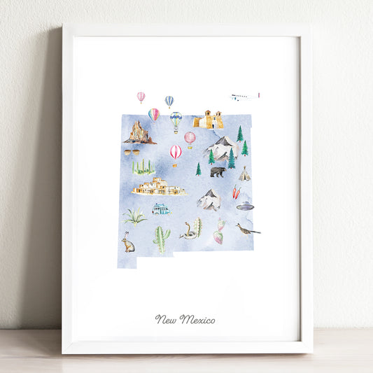
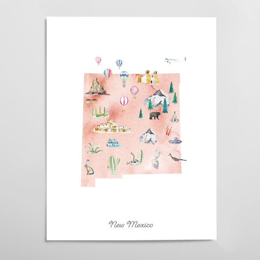
New Mexico Illustrated State Map Art Print
Regular price From $ 24.00Regular priceUnit price per0.00 0.00Sale price From $ 24.00- Gradient
- Black
- Pink
- Blue
-
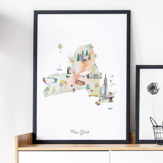
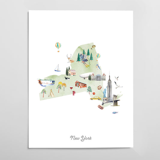
New York Illustrated State Map Art Print
Regular price From $ 24.00Regular priceUnit price per0.00 0.00Sale price From $ 24.00- Gradient
- Black
- Pink
- Blue
-
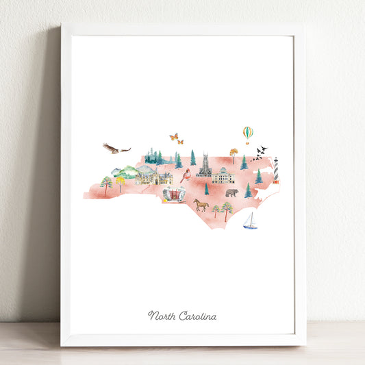
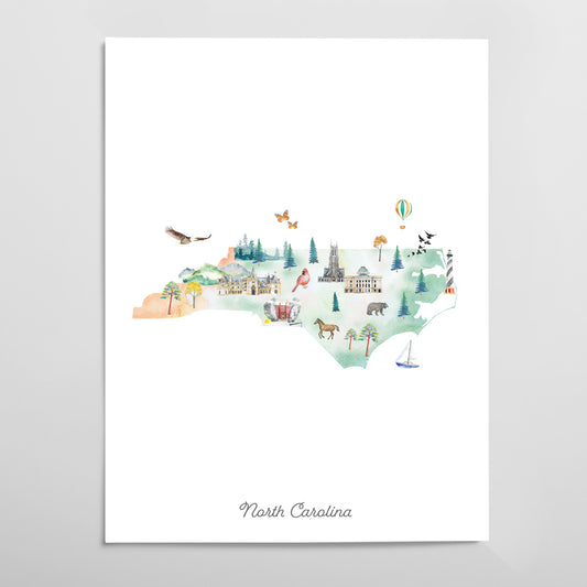
North Carolina Illustrated State Map Art Print
Regular price From $ 24.00Regular priceUnit price per0.00 0.00Sale price From $ 24.00- Gradient
- Black
- Pink
- Blue
-
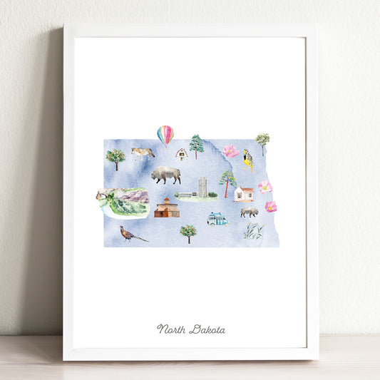
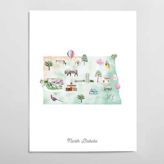
North Dakota Illustrated State Map Art Print
Regular price From $ 24.00Regular priceUnit price per0.00 0.00Sale price From $ 24.00- Gradient
- Black
- Pink
- Blue
-
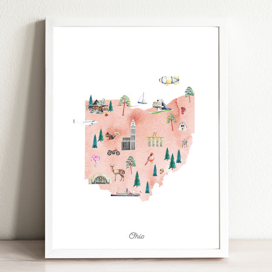
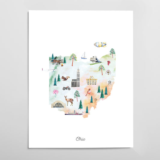
Ohio Illustrated State Map Art Print
Regular price From $ 24.00Regular priceUnit price per0.00 0.00Sale price From $ 24.00- Gradient
- Black
- Pink
- Blue
-
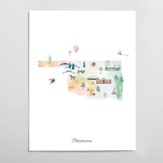
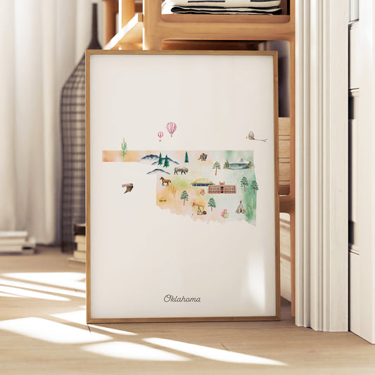
Oklahoma Illustrated State Map Art Print
Regular price From $ 24.00Regular priceUnit price per0.00 0.00Sale price From $ 24.00- Gradient
- Black
- Pink
- Blue
-
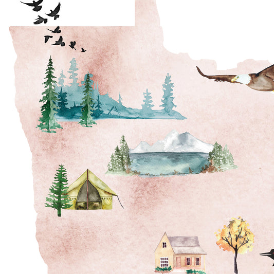
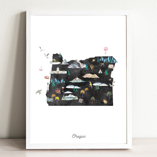
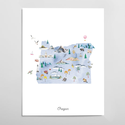
Oregon Illustrated State Map Art Print
Regular price From $ 24.00Regular priceUnit price per0.00 0.00Sale price From $ 24.00- Gradient
- Black
- Pink
- Blue
-
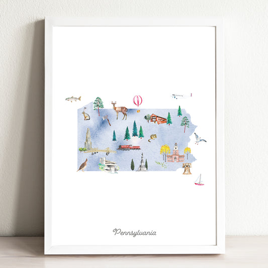
Pennsylvania Illustrated State Map Art Print
Regular price From $ 24.00Regular priceUnit price per0.00 0.00Sale price From $ 24.00- Gradient
- Black
- Pink
- Blue
-
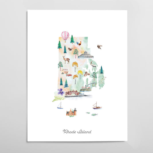
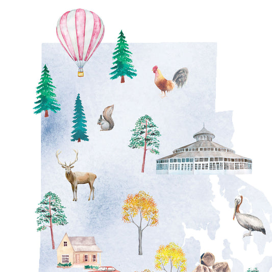
Rhode Island Illustrated State Map Art Print
Regular price From $ 24.00Regular priceUnit price per0.00 0.00Sale price From $ 24.00- Gradient
- Black
- Pink
- Blue
-
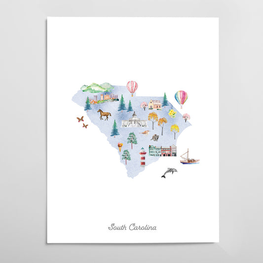
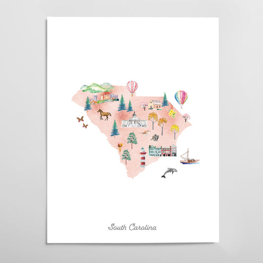
South Carolina Illustrated State Map Art Print
Regular price From $ 24.00Regular priceUnit price per0.00 0.00Sale price From $ 24.00- Gradient
- Black
- Pink
- Blue
-
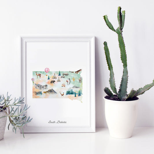
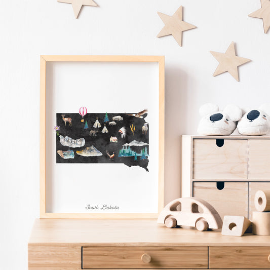
South Dakota Illustrated State Map Art Print
Regular price From $ 24.00Regular priceUnit price per0.00 0.00Sale price From $ 24.00- Gradient
- Black
- Pink
- Blue
-
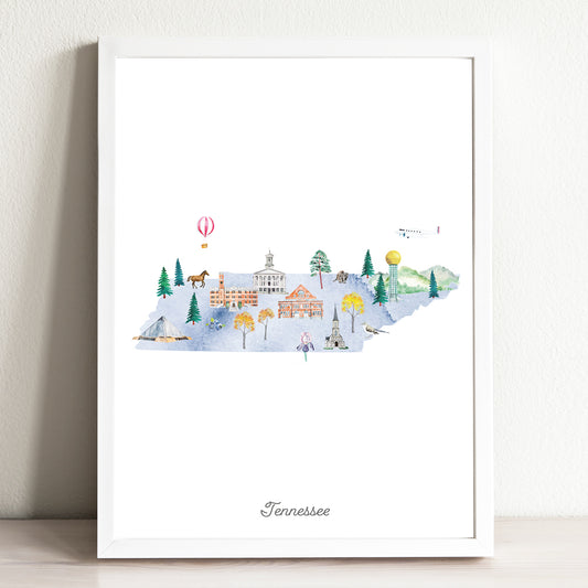
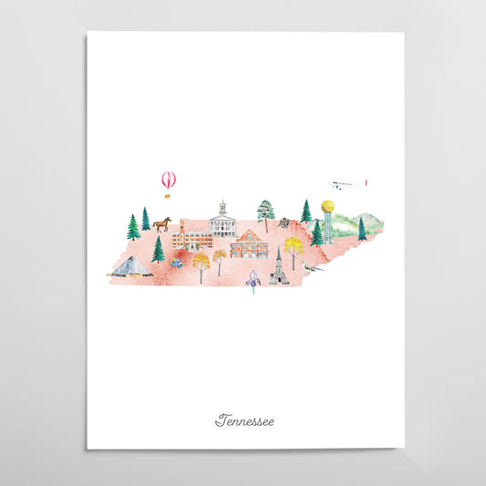
Tennessee Illustrated State Map Art Print
Regular price From $ 24.00Regular priceUnit price per0.00 0.00Sale price From $ 24.00- Gradient
- Black
- Pink
- Blue
-
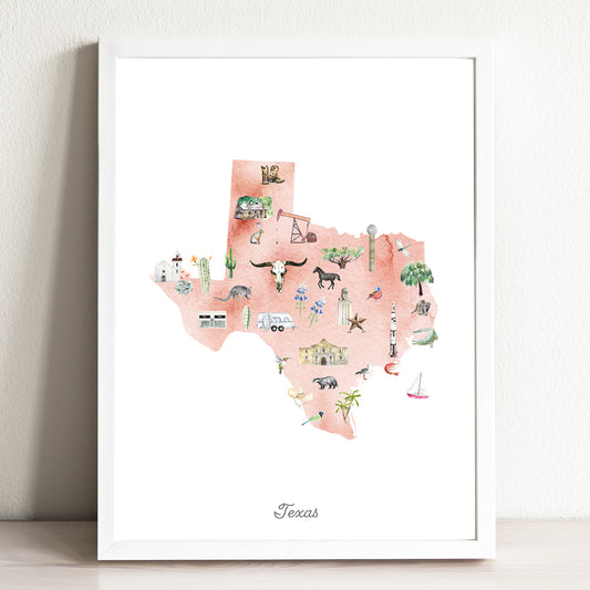
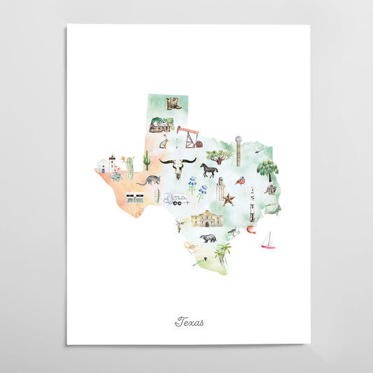
Texas Illustrated State Map Art Print
Regular price From $ 24.00Regular priceUnit price per0.00 0.00Sale price From $ 24.00- Gradient
- Black
- Pink
- Blue
-
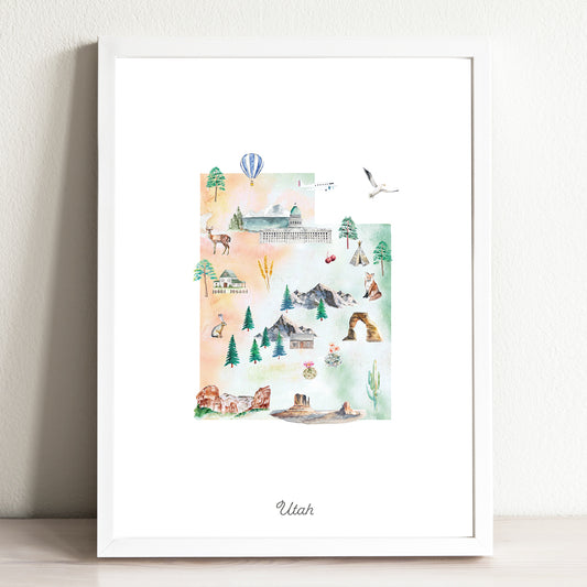
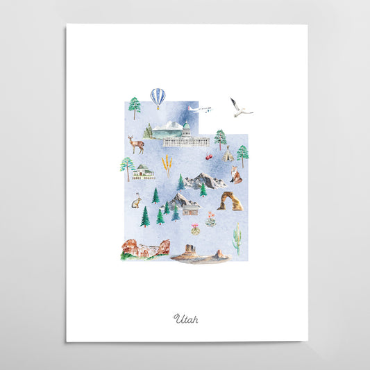
Utah Illustrated State Map Art Print
Regular price From $ 24.00Regular priceUnit price per0.00 0.00Sale price From $ 24.00- Gradient
- Black
- Pink
- Blue
-
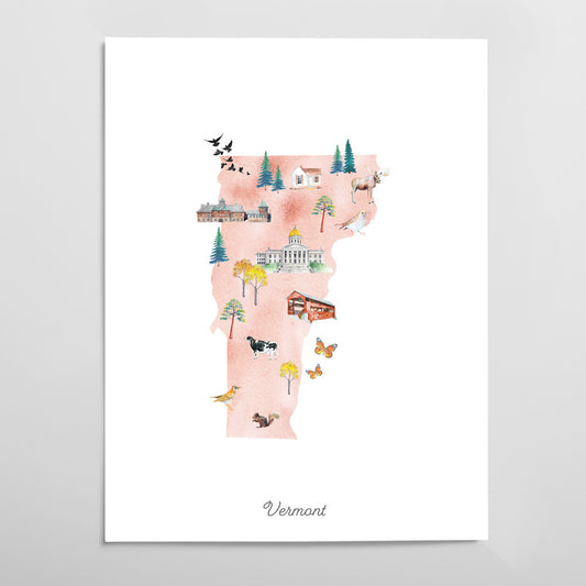
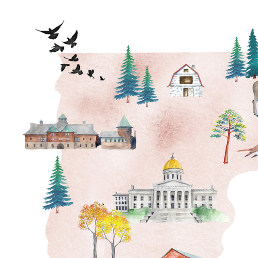
Vermont Illustrated State Map Art Print
Regular price From $ 24.00Regular priceUnit price per0.00 0.00Sale price From $ 24.00- Gradient
- Black
- Pink
- Blue
-
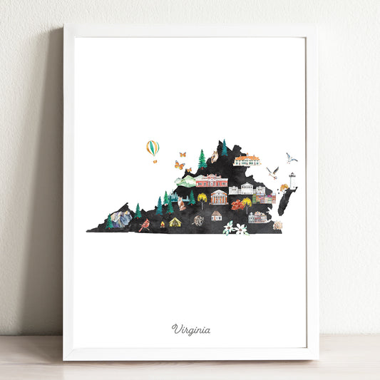
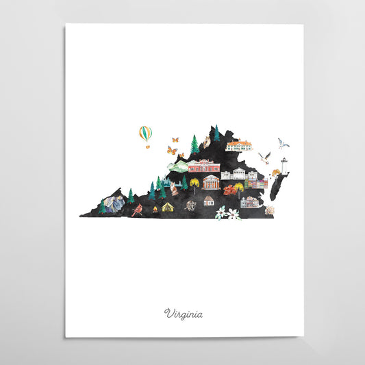
Virginia Illustrated State Map Art Print
Regular price From $ 24.00Regular priceUnit price per0.00 0.00Sale price From $ 24.00- Gradient
- Black
- Pink
- Blue
-
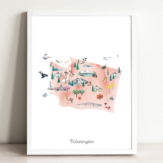
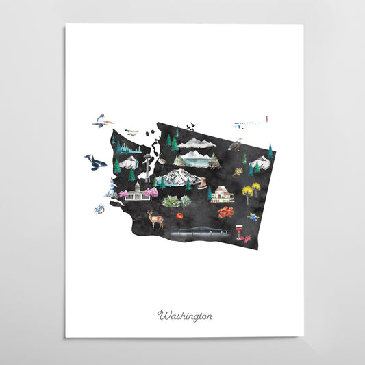
Washington Illustrated State Map Art Print
Regular price From $ 24.00Regular priceUnit price per0.00 0.00Sale price From $ 24.00- Gradient
- Black
- Pink
- Blue
-
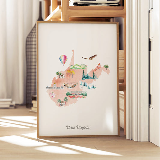
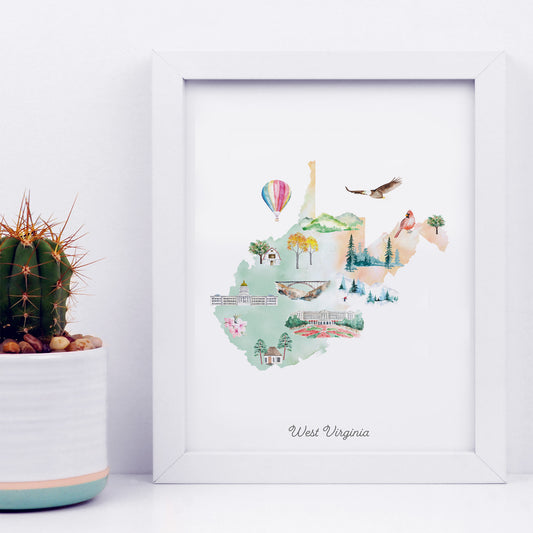
West Virginia Illustrated State Map Art Print
Regular price From $ 24.00Regular priceUnit price per0.00 0.00Sale price From $ 24.00- Gradient
- Black
- Pink
- Blue