Collection: Continent Maps

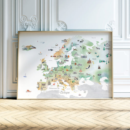
Our continent maps bring together geography, wildlife, landmarks, architecture, food traditions, and cultural references into layered visual studies of place. Each map is designed to encourage observation and connection, revealing how landscapes, histories, and everyday life shape different regions of the world.
Created as both art prints and visual references, these illustrated maps are filled with details to notice slowly over time, making them equally suited to shared family spaces, reading corners, classrooms, and collections of meaningful objects.
From regional cuisines and native animals to historic cities and natural wonders, the collection offers a broad introduction to the diversity and character of each continent through illustration, color, and carefully organized detail.
-
Illustrated Map of Europe
Regular price From $ 39.00Regular priceUnit price per